Environmental damage caused by earthquakes and Tsunami waves can cause damage to settlements and ecosystems of the environment, especially coastal areas. If you look at the condition of environmental management in Indonesia in particular. Coastal areas are quite apprehensive where there is massive control and exploitation of natural resources consequently ecosystem ligkungan existing in the coastal areas are not able to dampen the magnitude of the tsunami that occurred at that time. Strategies of natural changes in geology can be used as a guide to read and understand the signs of nature. Spatial planning based on the concept of sustainable development can also help prevent the deterioration of the environment even worse.
The environment is the unity of space with all things, power, circumstances and living things, including human beings and their behavior, which affect the viability of life and the well-being of human beings and other living beings.
Environmental management is an integrated effort to preserve the environmental function which includes the policy of structuring, utilization, development, maintenance, restoration, supervision and environmental control.
The occurrence of damage caused by disasters, especially on the environment requires serious attention from various circles both by the government and environmentalists. Therefore, a quick and accurate attitude and work of the Government is needed to determine the policy to overcome the environmental damage caused by the earthquake and tsunami waves. Commitment and totality are needed to overcome the national problems that are also the duties and responsibilities of these various elements of society.
 pixabay
WHAT IS THE TSUNAMI ....?
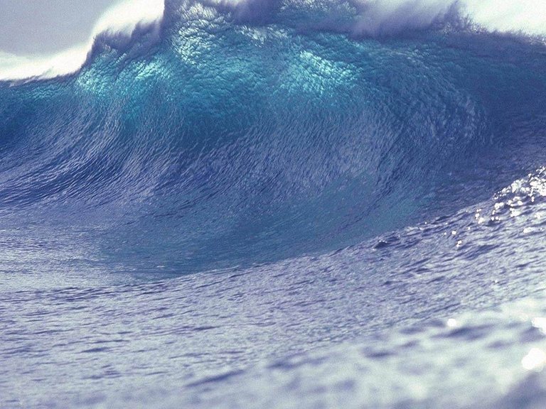
Tsunami is a series of ocean waves that can spread at speeds of up to 900 km per hour, mainly caused by earthquakes that occur in the seabed.
The term tsunami comes from the Japanese Tsu meaning port and nami means sea waves. From this story emerged the term tsunami. Initially the tsunami meant a sea wave that hit the harbor.
Tsunamis are mainly caused by earthquakes on the ocean floor. A tsunami triggered by a landslide on the seabed, a volcano eruption of the ocean floor, or a result of a meteor fall but is rare.
 pixabay
This vertical movement can occur on earth fault. The denser oceanic plate slopes beneath the continental plate in a process state called subduction, and subduction earthquakes are very effective at generating tsunamis. The speed of tsunami wave propagation ranges from 50 km to 1,000 km per hour. As it approaches the coast, its speed decreases, due to the friction of the seafloor, but its wave height will increase in size as it approaches the coast (reaching maximum height on shore-shaped beach and shaped like bay and river mouth). This event can cause erosion damage to coastal areas and islands.
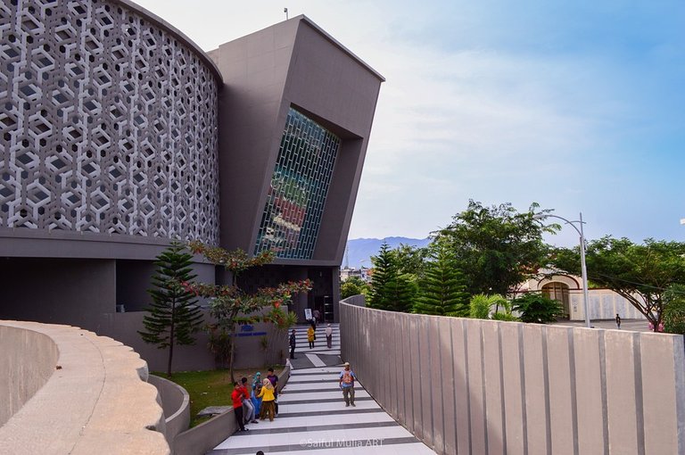 Museum tsunami aceh
The tectonic earthquake shook the region of North Sumatra and Nanggroe Aceh Darussalam (NAD) on Sunday 26 December 2004 measuring 6.8 on the Richter Scale Happened at around 8.00 WIB lasted approximately 5 minutes. Head of BMG Analysis Group I Sumbagut Medan region, the earthquake occurred 66 kilometers in the southern city of Meulaboh West Aceh, precisely on the west coast of Sumatra, the Indian Ocean or 3.61 North Latitude and 98.28 East Longitude. This earthquake occurred due to the collision of the slabs of Indo Australia and Euro Asia.
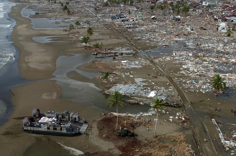
A powerful earthquake measuring 6.8 on the Richter scale followed by tsunami waves shook and devastated the area of North Sumatra and Nanggroe Aceh Darussalam (NAD). The 5-meter earthquake and tsunami waves that caused some of the Banda Aceh's mainland sank as high as 1.5 meters, and some areas of North Sumatra such as Nias and other coastal areas also experienced the same thing that caused a catastrophic death and destruction. This condition also occurs in some countries other than Indonesia such as India, Sri Lanka, Thailand and Africa.
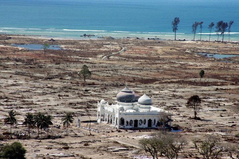 tsunami of aceh 2004
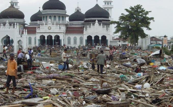 tsunami of aceh 2004
The impact of the post-tsunami is so felt for people and the environment around it, with the destruction of settlements and ecosystems of the environment, especially the coastal areas of Sumatra island that experienced massive destruction. The environmental losses are based on existing data of approximately 6 trillion rupiah.
The occurrence of the earthquake and tsunami is certainly not a mere natural disaster, but we also have to think why the ecosystem of the existing environment in the coastal area is not able to dampen the devastation of tsunami waves that occurred at that time. Moreover, the distance between the residential population bekisar between 200 - 300 meters from the sea lip that causes the number of victims who died.
If we look at the condition of environmental management in Indonesia, especially coastal areas is quite apprehensive where there is draining and exploitation of natural resources on a large scale with the aim to gain material benefits only without thinking about the negative impacts to the environment, both damage to natural resources and pollution living environment.
One of the most severe natural damages in the coastal area of Sumatra is the destruction of Mangrove Forest (Mangrove) about 63.5% of 85,393 Ha (Interpretation Citra Landsat, 1998) caused by the development of ponds, the opening of plantations and the rise of the mangrove charcoal industry such as in wildlife ivory and eastern corals, the west coast of North Sumatra and Nias, as well as some coastal areas of Nanggroe Aceh Darussalam (NAD).
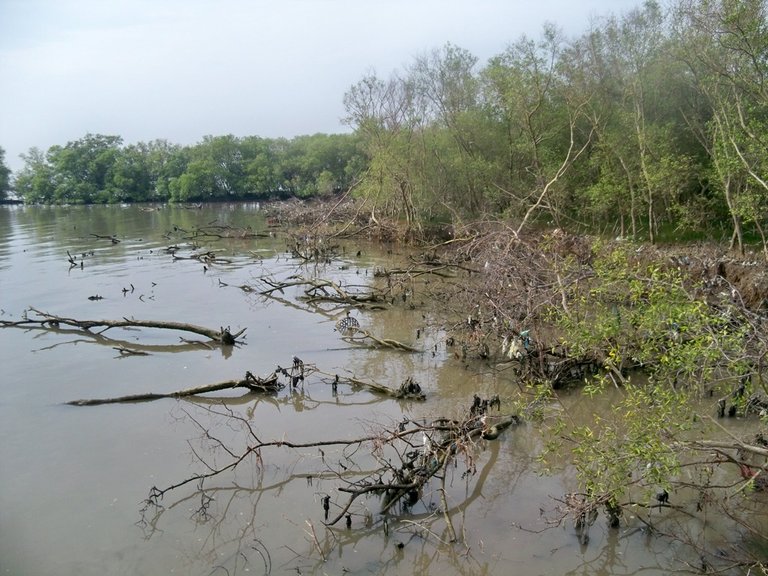 source
Action How To Do?
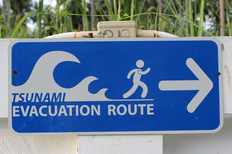 pixabay
This question and issue should be immediately followed up, why because it is urgent enough for life in the present and for the future. Many concepts are outlined as long as we have a shared commitment to performing sustainable stages.
The strategy of natural changes is basically geological, so that the effects of these changes on humans and the environment can be prevented or minimized immediately. Geologists should develop their expertise for early anticipation of natural disasters due to earth shifts and other geological phenomena. With expertise it can meginventarisasi seismic centers located in the territory of Indonesia, with terinventarisasinya facilitate the relevant sector to prevent before the occurrence of events as a preventive measure.
Then set the spatial arrangement that bebasiskan the concept of sustainable development (sustainable development) by creating and implementing green lane with a distance of 200 meters that must be planted with hard trees, such as mangrove that can function and able to withstand sea waves and will avoid sea abrasion. Rocks or Coral Reefs should not be damaged, as it acts as a breakwater.
Therefore, the government must take policy measures as an activity to overcome the environmental damage caused by the Earthquake and Tsunami in Nanggroe Aceh Darussalam and parts of North Sumatra by realizing the development after the earthquake and tsunami wave by conducting :
- Data Collection,
- Socialization,
- Refugee Relocation,
- Rehabilitation,
- Reconstruction,
- Monitoring.
From each policy step taken above is expected to produce an action that can anticipate the damage caused after the earthquake and tsunami waves.
Conclusion
Implementation of environmental management based on the principle of state responsibility, the principle of sustainability, and the principle of benefit, which aims to realize environmentally sustainable development in the framework of development.
Tsunamis are huge waves of water that are generated by various kinds of disturbances at the bottom of the ocean. This disturbance can be earthquake, plate shift or mountain eruption.Tsunami not visible while still far in the middle of the ocean, but once reaching the shallow areas, this fast moving wave will become more enlarged.Tsunami also often mistaken as tidal wave, because when it reaches the land of this wave is more like a high tide than resembling the ordinary waves that reach the beach naturally by the wind. But actually tsunami waves have nothing to do with tidal events.
activities to overcome the environmental damage caused by the Earthquake and Tsunami Waves in Nanggroe Aceh Darussalam and parts of North Sumatra by realizing the development after the earthquake and tsunami waves by doing:
- Data Collection
- Socialization
- Refugee Relocation
- Rehabilitation
- Reconstruction
- Monitoring
Supporting literature / Reference
- Syamsul Arifin (Guru Besar Fakultas Hukum USU Medan, Kepala Badan Pengendalian Dampak Lingkungan Propinsi Sumatera Utara) MENGURANGI KERUSAKAN LINGKUNGAN YANG DIAKIBATKAN OLEH GEMPA.
- UU No. 25 Tahun 2000 tentang Program Pembangunan Nasional
- www.pixabay.com
- Responsi, geology dasar, 2010, Departement pendidikan KM HMG “ARC-SINKLIN”
- Asikin, Sukendar. Basic of Geology. Departemen Geologi ITB
All about my article part1, part2, part3, part4,part5, part6, part7, part8, part9, part10, part11, part12, part13.part14, part15, part16..
science never die

by : @rabo


You received a 60.0% upvote since you are a member of geopolis and wrote in the category of "geology".
To read more about us and what we do, click here.
https://steemit.com/geopolis/@geopolis/geopolis-the-community-for-global-sciences-update-4
Peace, Abundance, and Liberty Network (PALnet) Discord Channel. It's a completely public and open space to all members of the Steemit community who voluntarily choose to be there.Congratulations! This post has been upvoted from the communal account, @minnowsupport, by rabo from the Minnow Support Project. It's a witness project run by aggroed, ausbitbank, teamsteem, theprophet0, someguy123, neoxian, followbtcnews, and netuoso. The goal is to help Steemit grow by supporting Minnows. Please find us at the
If you would like to delegate to the Minnow Support Project you can do so by clicking on the following links: 50SP, 100SP, 250SP, 500SP, 1000SP, 5000SP.
Be sure to leave at least 50SP undelegated on your account.