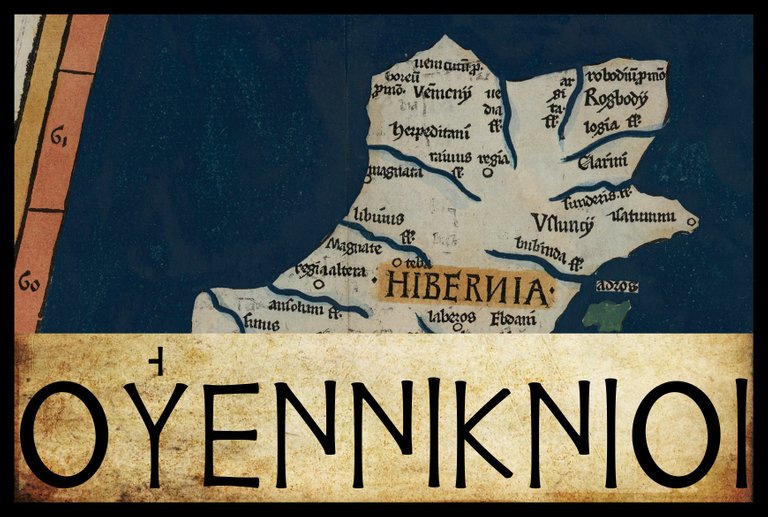
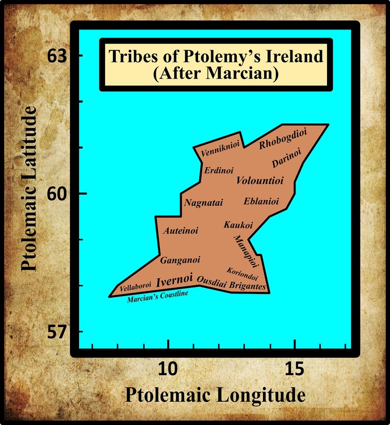
In his description of Ireland, Geography 2:2 §§ 1-10, Claudius Ptolemy records the disposition of sixteen Irish tribes. Beginning, as before, in the southeast corner of the island and proceeding in a counterclockwise direction, the ninth of these are the Venniknioi (Latin: Vennicnii or Vennicni). As these are included among the tribes on the west coast as well as those on the north coast, their territory must have lain in the northwest corner of the island.
In his 1883 edition of Ptolemy’s Geography, Karl Müller noted five variant readings of this ethnonym:
| Source | Greek | English |
|---|---|---|
| Most MSS | Οὐεννικνιοι | Venniknioi |
| α | Οὐενικνιοι | Veniknioi |
| W | Οὐεννικιοι | Vennikioi |
| Ψ | Οὐεννικνειοι | Vennikneioi |
| C, P, R, V | Ἐννικνιοι | Enniknioi |
| W | Ἐννικιοι | Ennikioi |
In Geography 2:2, Venniknioi occurs in the nominative plural. In 2:4, it is given in the accusative plural (governed by μετα [meta], “after”). In the table above, the latter has been transposed into the nominative plural.
α is identified by Müller as the Codex Ingolstadiensis. He refers to it as the Editio princeps, a term generally reserved for the first printed edition of a work. Today, the editio princeps is usually credited to Desiderius Erasmus, whose complete Greek edition—based on a manuscript provided by Theobald Fettich of Kaiserslautern—was published by Hieronymus Froben in Basel in 1533. Earlier in the same year, however, Peter Apian of Ingolstadt published an incomplete version of the Geography in Greek and Latin. I can only assume that Müller’s Cod α is a copy of this work.
W is a manuscript currently housed in the Vatican Library: Vaticanus Graecus 178.
Ψ is a manuscript from the Laurentian Library in Florence: Florentinus Laurentianus 28, 42.
C is Parisiensis Supplem 119. Presumably this is one of the Codices Parisini Graeci in the Bibliothèque nationale de France in Paris, though I have not been able to confirm this.
P and R are Venetian manuscripts identified by Müller as Venetus 383 and Venetus 516. They are possibly kept in the Biblioteca Nazionale Marciana, though I have not been able to confirm this.
The second and third variants—Οὐενικνιοι [Veniknioi] and Οὐεννικιοι [Vennikioi]—can probably be safely dismissed as simple scribal errors in which a single letter (ν, or nu) has been omitted. In the third variant—Οὐεννικνειοι [Vennikneioi]—an extra letter (ε, epsilon) has been added, but as this occurs in only a single manuscript, it too can probably be safely dismissed.
A Note on Ptolemy’s Diacritics
The fact that two of the variant readings of Οὐεννικνιοι [Venniknioi] are Ἐννικνιοι [Enniknioi] and Ἐννικιοι [Ennikioi] is interesting. In Celtic, v was pronounced like our modern semivowel [w], as it was in Classical Latin. In later forms of Irish, [v] and [w] are found, depending on the context and the dialect. As we have seen several times before in this series, Ptolemy used the Greek digraph ου [ou] to represent the Celtic letter v because the Greek letter digamma, which had formerly represented this sound, had fallen out of use (except as the numeral 6). T F O’Rahilly explained this practice in his Early Irish History and Mythology in connection with the Greek names for the island of Ireland:
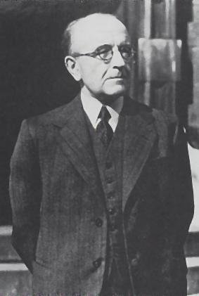
The name ’Ιέρνη, “Ireland”, had probably been picked up by the Massaliot Greeks, from merchants and from their Celtic neighbours, as early as the fifth century B.C. ... The digamma had disappeared from Ionic as early as the seventh century B.C.; and when Massaliot Greeks first heard the name Īvernā [Ireland], they presumably had no means of indicating the -v- and simply dropped it. Later the Greeks adopted the expedient of representing v in foreign names by ου ... We may take it that Pytheas [believed by O’Rahilly to be Ptolemy’s principal source for Ireland] retained the traditional name ’Ιέρνη ... whereas in dealing with other names previously unrecorded, we find him representing Celtic v by Greek ου, as for instance in ... Bouvinda [Βουουινδα] ... Ptolemy, or some near predecessor of his, modernized ’Ιέρνη into ’Ιουερνία [Ivernia] ... (O’Rahilly 41-42)
As it happens, the two variant readings of Venniknioi in which this initial digraph is missing are only found in Geography 2.4, and never in 2.2. It appears, then, that the raw data which Ptolemy used for this ethnonym did not have the digraph—Pytheas had simply dropped it. Ptolemy or his copyist subsequently inserted it in 2.2 but forgot to include it in 2.4. In my opinion, this is striking confirmation that O’Rahilly’s hypothesis is correct.
In the thumbnail image at the top of the page, I have included the Alexandrian smooth breathing over the upsilon of the initial digraph. The use of rough and smooth breathing to indicate whether an initial vowel sound was aspirated [h-] or not was in its infancy in Ptolemy’s day. It is believed that Ptolemy would only have employed it in cases where its presence was absolutely necessary—as, for example, in the case of foreign ethnonyms (Gnanadesikan 220).
Identity
In Ptolemy’s Geography, the Venniknioi gave their name to one of the headlands or promontories on the north coast of Ireland. In an earlier article in this series I tentatively identified this Οὐεννικνιον Ακρον [Cape Venniknion] with Malin Head (or, more accurately, Banba’s Crown), the most northerly point on the island of Ireland. As I noted, it would be extraordinary if Ptolemy had omitted to include in his description of Ireland the most northerly point on the island. Other scholars have identified cape Venniknion with Horn Head, Inishowen Head and Fanad Head—usually on account of the etymology or the geographical coordinates. All four candidates are in County Donegal.
In 1789, the Irish architect and scholar William Beauford identified the promontory with Malin Head and offered the following curious analysis:
Οὐεννικνιον Ακρον [Venniknion Akron] seems to be the Bhen nigh nion of the Irish, pronounced nearly Vennicnion, being the most northern headland of Innis Owen, in the county of Donegal, which still among the natives retains its ancient name ... on the west of this (that is the [north] coast) dwell the Venicnii. The Romans do not appear to have obtained the name of the inhabitants of this district, but to have called them from the neighbouring cape. They were the ancient inhabitants of the northern parts of the county of Donegal. (Beauford 54 ... 55)
It makes more sense for the promontory to have taken its name from the people, and not the other way round. As for Beauford’s assertion that Malin Head was also, or formerly, known in Irish as Bhen nigh nion, I am at a loss to explain it. I have never come across such a designation. Perhaps Beauford was thinking of Banba’s Crown [Coróin Bhanba], the name of the small tiara-shaped rock on Malin Head that represents the most northerly point of the headland.
Is it possible that there is a connection between Venniknion and Banba? This is highly unlikely. In Celtic, the initial v- [w] generally evolved at an early stage into the bilabial spirant [β], which was written b-, but this in turn gave rise to the Old Irish f-. There would also be no satisfactory way of accounting for the subsequent -ba (Thurneysen §187 (c), §201, §202).
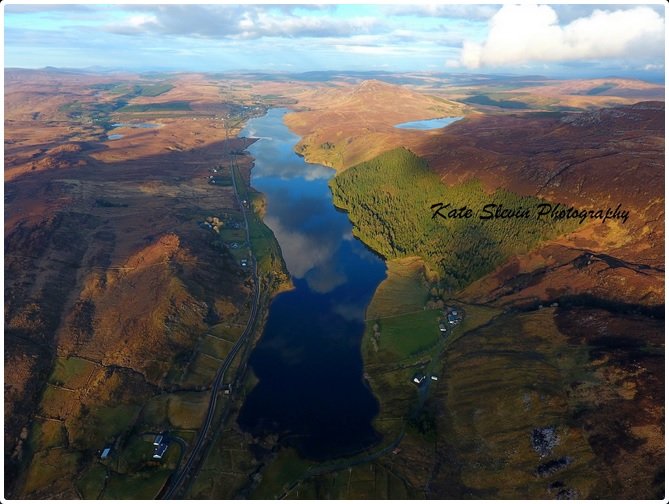
Goddard H Orpen was one of the first to suggest an etymological link between Venniknioi and the name of the River Finn, which flows from Loch Finn in County Donegal, and creates the River Foyle at its confluence with the River Mourne near the towns of Lifford and Strabane:
As regards the tribal names the Οὐεννίκνιοι [Venniknioi] are placed to the west, and the Ῥοβόγδιοι [Rhobogdioi] to the east. The former occupied the later Tir Chonaill [County Donegal], including Inis Eoghain [Inishowen] ... Perhaps the river now written Finn, but in old maps Finne, or Finny (Ir. Fionna; Adamnan, Fenda], which flows through Donegal into Loch Foyle, is connected with the name Οὐενν-ίκνιοι , the Irish initial F as usual taking the place of the Indo-Germanic V, represented by the Greek ου [ou]. The river name is certainly not derived from finn = white : see Joyce’s “Irish Names,” i. 174-5, where the wild legend of the origin of the name is told. Na trí Fionna of the “Four Masters,” A.M. 3520, refer apparently to this river and its tributaries. (Orpen 117)
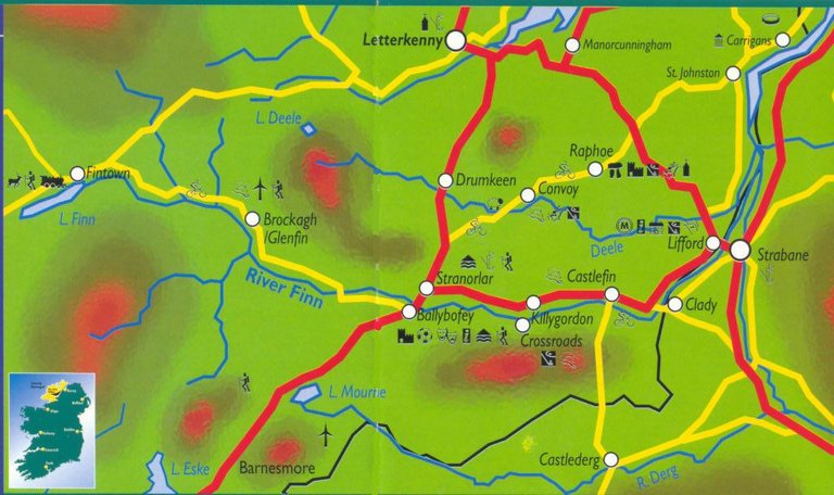
John O’Donovan, the translator of The Annals of the Four Masters, surmises that the three Finns were the River Finn and two of its tributaries (O’Donovan 37). The passage cited from Patrick Weston Joyce’s The Origin and History of Irish Names of Places reads:
Fergoman had a sister named Finn, who was as warlike as himself; and after long fighting, when he was lacerated by the sow’s tusks and in danger of death, he raised a great shout for his sister’s help. She happened to be standing at the same side of the lake, but she heard the echo of the shout from the cliffs on the opposite side; she immediately plunged in, and swam across, but as she reached the shore, the voice came from the side she had left, and when she returned, the echo came resounding again from the opposite cliffs. And so she crossed and recrossed, till the dreadful dying shouts of Fergoman so overwhelmed her with grief and terror, that she sank in the middle of the lake and was drowned. Hence it was called Loch Finne, the lake of Finn, and gave also its name to the river ...
Whatever may be thought of this wild legend, it is certain that the lake received its name from a woman named Finn, for it is always called in Irish Loch Finnĕ, which bears only one interpretation, Finn’s or Finna’s lake ; and this is quite consistent with the name given by Adamnan to the river, namely, Finda. The suggestion sometimes put forth, that the name was derived from the word finn, white or clear, is altogether out of the question; for the waters of both, so far from being clear, are from their source all the way down to Lifford, particularly remarkable for their inky blackness. (Joyce 174-175)
Martin Counihan
The independent researcher Martin Counihan has recently revisited the etymology of Venniknioi and come up with some interesting ideas:
The name of the Vennicnii, living in the northernmost part of Ireland, is essentially the same as that of the Venicones, a tribe whom Ptolemy listed in the region of Fife on the east coast of Scotland. Both names are similar to a Gaulish word, uenicos, “clan member”. Vennicnii would simply mean something like “the tribespeople” or “the family”. (Counihan 13)
It may be noted here that T F O’Rahilly does not even discuss the tribal name Venniknioi in his Early Irish History and Mythology, including it among the Ptolemaic names of which “there is no trace in our native records” (O’Rahilly 2). In a later passage, however, he dismisses Ptolemy’s Venikones as a bad corruption of Verturiones, a Scottish tribe attested in Ammianus Marcellinus and borrowed into Irish as Fortrinn (O’Rahilly 382 fn 2).
Counihan continues:
It is tempting to link the Vennicnii and Venicones with the better-known Veneti of western Gaul (who gave their name to the city of Vannes), to the Veneti of the Adriatic (whence Venice), and to yet another Veneti who lived in the region of the Vistula which runs into the Baltic (the river Venta, to the east of the Vistula, preserves their name). At the present stage of research it is not possible to discern the connections, if any, amongst the Vennicnii, Venicones, and the three Veneti, although their names may all come from the same Proto-Indo-European root to do with “family”.
As well as the tribe of Vennicnii, Ptolemy mentioned a headland called Promontorium Vennicnium on the north coast. Several writers have identified it as Horn Head, about 50 km north-west of Derry City. Horn Head is only about 5 kilometres north of the small town of Dunfanaghy, and there is an intriguing possibility that the name of the Vennicnii may be reflected in that of Dunfanaghy. Also, there is Fanad Head, a promontory with a lighthouse on the coast about 20 km east of Horn Head. Fanad, likewise, may reflect the name of the Vennicnii. In the development of Irish from earlier Celtic, the consonant v regularly became an f, and the vowel e in these circumstances generally became an i. For example, the Irish word fír corresponds to the Latin verus, both meaning “true”. So, a later counterpart of Vennicnii might have been something like Finicni. In Old Irish, fine means “family”; finech is an adjective which may be translated as “tribal”; and finedach means a “family-stock” or “clan”.
In Modern Irish today, Dunfanaghy is written as Dún Fionnachaidh, “Fort of the Bright Field”, but this may well have arisen in more recent times from a kind of folk etymology—a metathesis and reanalysis of finedach to fionnachaidh, the name having originally meant “Tribal Fort”. Likewise, the name of Fanad Head, which in Modern Irish is written Cionn Fhánada, may also come from Finedach. It is therefore reasonable to suppose that both names have descended from the original Archaic Irish group-name that was rendered into Latin as Vennicnii. In view of the general imprecision of Ptolemy’s coordinates, either Horn Head or Fanad Head could correspond to Promontorium Vennicnium, but on balance it seems most likely that Promontorium Vennicnium is Fanad Head.
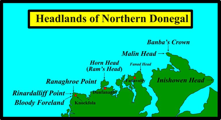
In passing: yet another place-name which possibly may reflect the Veniccnii is that of the townland and hamlet of Fanavolty which is close to Ballyhiernan Bay and about 5 km from Fanad Head. Today, the Irish form of Fanavolty is considered to be Fán an Bhualtaigh, which literally means “shit-hole”. But here, again, folk etymology may have been at work, and we may have instead Finech Búaile, “tribal cattle-pen”. (Counihan 13-14)
As my mother is from Fanad and my father is buried in Fanavolty Cemetery, I feel honour-bound to point out that Fán an Bhualtaigh translates literally as The Slope of the Cow Dung, and not shit hole! Fanavolty sits on sloping ground on the shores of the picturesque Kindrum Lough.
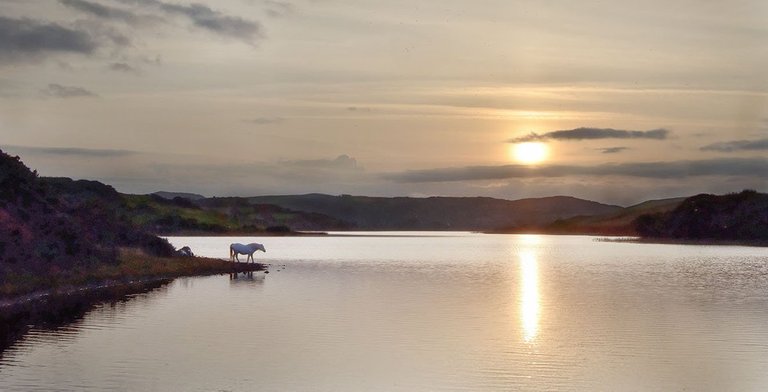
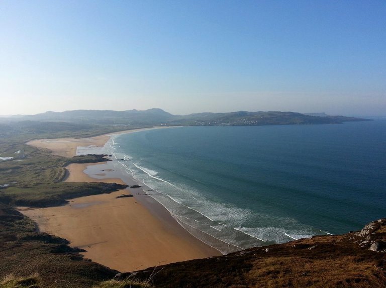
Counihan’s etymologies are imaginative, but also quite speculative. Fánaid is generally understood to means something like [Land of] Sloping Hills, an accurate description of Fanad’s glacial drumlins. On the other hand, Dunfanaghy’s Irish name may well be a corruption of an older name the original signification of which had been lost over time.
Cenél Conaill
In historical times, the predominant tribe in the northwest of Ireland was the Cenél Conaill. According to tradition, these were the descendants of Conall Gulban, a 5th-century son of Niall of the Nine Hostages. As the latter was a Gaelic ruler of Tara in the midlands, the Cenél Conaill were alleged to be 5th-century invaders from the south. Recently, however, a number of scholars have suggested that this link between Cenél Conaill and Niall’s dynasty may well be a learned fiction and that the Cenél Conaill were actually the descendants of the original inhabitants of this part of the country—ie Ptolemy’s Venniknioi.
There is much to be said in favour of this hypothesis. The medieval scribes were notorious for forging genealogies for political reasons (O’Rahilly 260-285), and it is very suspicious to learn from them that Niall had two sons called Conall: Conall Gulban and Conall Cremthainne. what father would give the same name to two of his offspring? A brief synopsis of this hypothesis can be read online on Dane Pestano’s blog Dark Age History: Vennicni, Feni and Donegal:
In this article I will be exploring the terms Vennicni, Feni and Gwynedd in relation to the early medieval tribes of Donegal, particularly the Cenel Conaill and examine the legend of the Ui Neills. I will endeavour to show that the Vennicni were the forerunners of the Feni who were in turn the Cenel Conaill of Donegal. In doing so I hope to confirm the work of Brian Lacey who has suggested that the Northern Ui Neill were a fabrication and that the Cenel Conaill and Cenel Eoghan were always resident in the area from pre-history as recent DNA findings may confirm. (Pestano)
Roman Era Names
As usual, the contributors to the toponymic website Roman Era Names have devised their own Indo-European etymology:
Ουεννικνιον ακρον (Wenniknion 2,2,2), was probably Inishowen Head, the eastern tip of Donegal, by the entrance to Lough Foyle. It was presumably named from people called *Ουεννικνιοι, compounded from two elements found right across ancient Europe: *wen- ‘friends, our people’, is discussed under Venta; –ikno (and similar forms) was patronymic, not implying close relationship ‘son of’ so much as ‘descendant’, rather like Mac- or –son in British surnames. (Roman Era Names)
Conclusions
Ptolemy’s Venniknioi do not seem to have left any descendants behind them in the north or northwest of Ireland—at least none who preserved this particular ethnonym. It is possible, however, that a trace of this tribal name can still be found in some local toponyms, such as the river- and lake-name Finn.
References
- William Beauford, Letter from Mr. William Beauford, A.B. to the Rev. George Graydon, LL.B. Secretary to the Committee of Antiquities, Royal Irish Academy, The Transactions of the Royal Irish Academy, Volume 3, pp 51-73, Royal Irish Academy, Dublin (1789)
- Martin Counihan, Researchgate (2019)
- Patrick S Dinneen, Foclóir Gaedhilge agus Béarla: An Irish-English Dictionary, Irish Texts Society, M H Gill & Son, Ltd, Dublin (1904)
- Amalia E Gnanadesikan, The Writing Revolution: Cuneiform to the Internet, Blackwell Publishing, John Wiley & Sons, Ltd, Chichester (2009)
- Patrick Weston Joyce, The Origin and History of Irish Names of Places, Volume 1, Longmans, Green, & Co, London (1910)
- Karl Wilhelm Ludwig Müller (editor & translator), Klaudiou Ptolemaiou Geographike Hyphegesis (Claudii Ptolemæi Geographia), Volume 1, Alfredo Firmin Didot, Paris (1883)
- Karl Friedrich August Nobbe, Claudii Ptolemaei Geographia, Volume 1, Karl Tauchnitz, Leipzig (1845)
- Karl Friedrich August Nobbe, Claudii Ptolemaei Geographia, Volume 2, Karl Tauchnitz, Leipzig (1845)
- John O’Donovan (editor & translator), Annals of the Kingdom of Ireland by the Four Masters, Second Edition, Volume 1, Hodges, Smith, and Co, Dublin (1856)
- Thomas F O’Rahilly, Early Irish History and Mythology, Dublin Institute for Advanced Studies, Dublin (1946, 1984)
- Goddard H Orpen, Ptolemy’s Map of Ireland, The Journal of the Royal Society of Antiquaries of Ireland, Volume 4 (Fifth Series), Volume 24 (Consecutive Series), pp 115-128, Dublin (1894)
- Claudius Ptolemaeus, Geography, Biblioteca Apostolica Vaticana, Vat Gr 191, fol 127-172 (Ireland: 138v–139r)
- Rudolf Thurneysen, Osborn Bergin (translator), D A Binchy (translator), A Grammar of Old Irish, Translated from Handbuch des Altirischen (1909), Dublin Institute for Advanced Studies, Dublin (1946, 1998)
- Friedrich Wilhelm Wilberg, Claudii Ptolemaei Geographiae, Libri Octo: Graece et Latine ad Codicum Manu Scriptorum Fidem Edidit Frid. Guil. Wilberg, Essendiae Sumptibus et Typis G.D. Baedeker, Essen (1838)
Image Credits
- Ptolemy’s Map of Ireland: Wikimedia Commons, Nicholaus Germanus (cartographer), Public Domain
- Greek Letters: Wikimedia Commons, Future Perfect at Sunrise (artist), Public Domain
- T F O’Rahilly: Copyright Unknown, Fair Use
- River Finn, County Donegal: © Donegal Local Development CLG, Fair Use
- Kindrum Lough, Fanavolty: © Declan McGuinness, Fair Use
- Ballymastocker Bay, Fanad: © Daniel Collins, Fair Use
- Lough Finn, County Donegal: © Kate Slevin Photography 2019, Fair Use

good .overall good geographical post.
great historical post dear brandon